Heading

                                              Click to see                                        Click to see

Friday, May 20, 2016

The Last 200 Yards - From my Point of View


Running out of Road

Ran out of Road - Dipping of the wheel.
Finally ran out of road. The traditional dipping of the wheel - in my case both wheels and both feet - in the Atlantic. Cal and the local Hilton Head Island Biking ambassador were there to help me get un-stuck.

Wednesday, May 18, 2016

Alligators for real

1 mile to go

Spanish Wells Road Bike Path

Only 6 miles to go

Second Bridge

First was too dangerous to stop at and feel safe. This is crazy traffic!

Finally - A dedicated bike path

At mile 11... a dedicated bike lane. First concession made for cyclists that I've encountered since I left home. These rich folks sure know how to do it right. 278 to this point was terrible - like I 75 with no shoulder.

Day 10 - Hardeeville to Hilton Head SC - 30.3 miles

A Snob
Finally, I found a use for the hair dryers they have in the hotel bathrooms. I just used it to dry my shoes out from yesterday's rain ride. It is a welcomed irony that the last day of a mostly mountainous ten day trek is the shortest and flattest ride of the entire journey. 30.3 miles of of the most prostrate terrain you could hope for. Weather forecast couldn't be better. Overcast and only a 15% chance of rain.  Mid-ride, at mile 13, I will hit a 1.3% grade that climbs to 28 ft above sea level (Big Deal!). From there, it's all downhill until I eventually arrive in Hilton Head at 9 ft above sea level. There will be lots of traffic the closer I get to Hilton Head. I have posted a Google Earth Video of Day 10 on YouTube. I tried to get fancy and go from sky view to street view and back. I think it really confused the Google Earth Movie Maker though. So in spite of a few hiccups, it's a pretty good view of my path into Hilton Head. Keep in mind that YouTube tends to drop videos down to low-res. All my videos are in high definition, so you may need to change the default resolution in the YouTube player to HD. Notice the four lane US Highway 278 all the way in and all of the shopping centers along the entire 30 miles.
A Bridge

[Check Out Last Years Trip to Panama City]


Hilton Head ranks as 
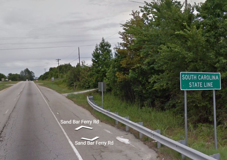
the second snobbiest place in South Carolina.  It’s so snobby it actually has a moat around itself to keep the common folk out. Approximately 70% of the island, including most of the tourist areas, is located inside gated communities.  Median Household Income: $70,041 -  Median Home Price: $477,100.  Rumor has it that there is a snobby tourist test you have to take in order to gain entrance to the island. Today's short ride will mostly be on four lane US Highway 278. East of Interstate 95, 278 runs as the main artery into posh Hilton Head. It's all new, green and manicured. You know a road has arrived when it has a bunch of official names. This 30 mile stretch of US Highway 278 starts out as Independence Boulevard, then becomes Fording Island Road, then changes to William Hilton Parkway followed by Cross Island Parkway, followed by Palmetto Bay Road, and ending as Pope Avenue. On previous days I traveled 278 West of Interstate 95 and it was the ugly twin of the eastern side. On the western side, it was mostly two lane and not very pretty. Hopefully, the parade of Mercedes-Benzes, Bentleys, Audis and Land Rovers heading from I-95 into Hilton Head will be well behaved, unlike their logging trucker cousins.
The End
I will pick up a dedicated Bike Lane on Cross Island Parkway (aka US Hwy 278) - the last of three major four lane bridges that I will cross today. I plan to arrive at Coligny Circle at Coligny Beach Park. I like big traffic circles. This has been a crazy ride. All manner of terrain - from the Georgia mountains to the Low Country swamps. I've met a lot of people. Most notably, the gay son with aids who was taking care of his mother and Shirley, who owns and runs a little country store in Furman SC. She lives behind the store in the house she grew up in. Her mom and dad ran it and now that they have passed, she carries on. She's about my age and works 11 hours per day, by herself. One pump, soft drinks and a few groceries. Go Shirley.
Flaaaaaaaaaaaaaaaaaaaaaaaaaaaaaaaaaaaaaaaaaaaaaaaaaaaaaaaaaaaaaaaaaaaaaaaaaat

Tuesday, May 17, 2016

Day 9 - Hampton to Hardeeville SC - 47.7 miles

Why did the reptile cross the SC Highway?
Today's ride - from Hampton to Hardeeville - is 47.7 miles.  As you can see from the elevation graph, it's practically flat all day. The highest point is at mile 9.1 at a whopping 124 ft. By the time I get to Hardeeville I'll be at 20 ft. above sea level.  Today's ride will take me on several stretches of County Roads. County Roads are those that are  maintained by the county highway departments. They usually run through some pretty remote or desolate areas and can often be in various states of "needing to be worked on".

The four regions of SC
The state of South Carolina is divided into four regions - Upstate, Midlands, Pee Dee (stop laughing) and Low Country. Beginning today, and for the rest of the trip, I am officially in Low Country. Swamps, lush green forest, black water rivers and creeks, coastal marshes, and south eastern coastal wildlife (including alligators) abound in the SC Lowcountry region.
Cell service probably not available here
Several of the county roads I'll be traveling today have been raised, with swamps on both sides of the road. Most probably, there will be no cell service, very few homes or businesses,sparse traffic and alligators. A breakdown or flat would not be good today. OK Google! How fast an alligator can run? - I plan to stay at Holiday Inn Express & Suites 145 Independence Boulevard   Hardeeville,  South Carolina  29927 - 1-843-784-2800

Flat-lining in Low Country

1st Stop of the Day

Furman SC. Mile 17. Left early trying to beat thunderstorms moving about noon. Ride is flat. Avg speed so far 16.5. Covered about 1/3 of today's distance.

Hardeeville Arrival

Arrived Hardeville just now. Beat thunderstorms but not the rain. Last 6 miles were in heavy truck traffic and rain. Standing outside motel draining before going in. Had to stop 5 miles out and secure electronics from rain. Put a ziploc bag over Bionx Controller. Stowed the rest in waterproof panniers. Got here too early to check in. Cold, wet, and killing time.

First Blow- Off

Just had a logger blow me off the road - I think on purpose. He had room to go around.Most of the loggers have been fairly courteous. Thought I would stop and re-group here at St. Mary Baptist. 14 more miles of this horrible road.

Monday, May 16, 2016

Uh.. Say What?

Arrival Hampton SC.. They must like watermellons

The Reason !

These guys have been scaring the heck out of me for the last 6 miles

SC Peaches

Now .. Mile after mile of peach trees

Your Future Toilet Paper

Miles after mile of pulpwood Trees... Going to paper mill one day

Corn Corn Corn

Finally... No truck..No Cars.. No Humans.. Just a country road and a lot of corn... On the way to
Hampton

Day 8 - Barnwell to Hampton SC - 33.7 miles

The ONLY stop of the day - at mile 4
This is one of my shortest days of the trip at 33.7 miles. See the Video Here. Terrain is light rolling until mile 15 and then it's downhill for the rest of the day. I've looked at every inch of the route in Google Street View and Google Earth and
I believe that Shelton's Gas and Convenience Store at mile 4 is the ONLY retail outlet of any kind until I reach Hampton. Some of the roads I'll be on today appear to be paved but I believe they are a hard-packed sand and gravel mix.  I'll be in farm country for awhile and then in pulp forest at other times. International Paper has had a presence in this area since the 1940's but in 2014 they closed the plant and moved operations to Maine - leaving 220 people jobless. The area around Hampton was the location of a POW camp during WWII - housing German and Italian prisoners from North Africa.
Worst case - narrow, no shoulder, big trucks - Living on the White Line today
U.S. Route 278 is the primary east–west United States highway that traverses through the South Carolina Lowcountry, from North Augusta to Hilton Head Island. US 278 was established, in South Carolina, in 1965. Parts of it that I will travel on are still only two-lane with no shoulder. I plan to Stay at Days Inn 1235 W Elm Street,  Hampton, SC  29924 - 1-803-943-0411.
Downhill last half of the day

Sunday, May 15, 2016

Arrived Barnwell

Few miles to go to Carolina Lodge

Lilly Pads

Needed a break anyway

38 miles to go

All on one long straight road... With a shoulder that is basically unusable due to feel grooves made to sound off if car tires run onto the white line.

South Carolina State Line !

Bye Bye Georgia and good riddance mountains

Half & Half

Front tire in South Carolina... Rear tire in Georgia

Day 7 - Augusta GA to Barnwell SC - 49.1 miles

After a long ride you can't beat a round bed with a trompe l'oeil Mediterranean View 
Today's ride is the longest and most desolate of the entire tour - 49.1 miles. Watch the Video Here. At around mile 11 this morning, I cross the Savannah River into South Carolina. Extreme, and I mean E-x-T-r-E-m-E, rolling hills will be begin at mile 11 as well and last all day long. At mile 12.5 there is a McDonald's and a  Family Dollar. At  mile 18.0 there is Kelly's Hilltop Stop N Shop.  At mile 18.7 another Dollar General.  Then, at mile 19, all civilization fades away for the day. The  Kool Spot Cafe and Food Mart at mile 19 is the last place for sustenance until the end of the ride in Barnwell at mile 49. Thirty (30) miles of nothingness that perfectly exemplifies Western South Carolina - it was that way thirty years ago and it's still that way today. I'll have to get all fluids and food for the day in metropolis of Spiderweb SC.  I plan to stay at the Carolina Lodge 10645 Dunbarton Blvd Barnwell, SC  29812 259-2014.
South Carolina State Line - from Google Street View
The Carolina Lodge appears, decoratively and architecturally, to be a cross between The Alamo, The Playboy Mansion and a New Deli Hostel.  I hope I can get the BRRCBLMC room tonight ( Bright Red Round Canopied Bed with Lighted  Mirrored Ceiling ) - always been a fantasy of mine. Fast Food Fare (Pizza Hut, McDonald's, KFC, Hardee's) and Reid's Grocery Store (11 store chain of outdated Food Lions that is now owned by BI-LO) are the only options for food tonight and in the morning.

This is what the day looks like - elevation-wise - Rollllllling hills - lots of 4,5 & 6 % grades